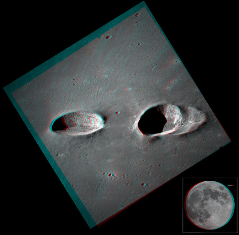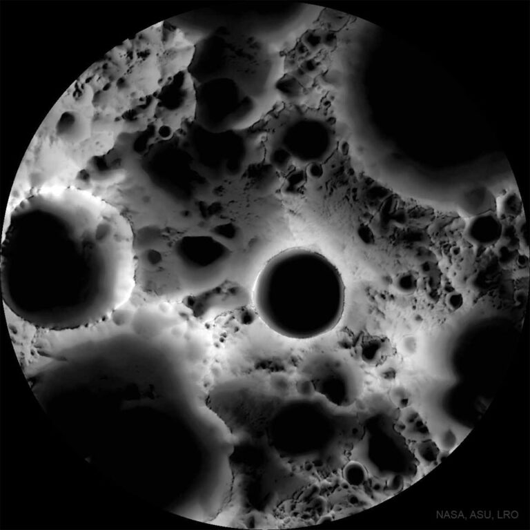
月球南极的阴影图
2022年4月10日 Shadows at the Moon’s South Pole Image Credit: NASA, Arizona State U., Lunar Reconnaissance Orbiter Explanation: Was this image of the Moon’s surface taken with a microscope? No — it’s a multi-temporal illumination map made with a wide-angle camera. To create it, the Lunar Reconnaissance Orbiter spacecraft collected 1,700 images over a period of 6 lunar days (6 Earth months), repeatedly covering an area centered on the Moon’s south pole from different angles. The resulting images were stacked to produce the featured map — representing the percentage of time each spot on the surface was illuminated by the Sun. Remaining convincingly in shadow, the floor of the 19-kilometer diameter Shackleton crater is seen near the map’s center. The lunar south pole itself is at…