标签: 陆地

巴西的新月形沙丘

Former NASA astronaut Jack Fischer captured this photograph of Lagoa dos Barros and crescent-shaped barchan dunes on the Atlantic coastline of southern Brazil on July 9, 2017, while aboard the International Space Station. Barchan dunes are sand dunes that form in areas with one wind direction and little vegetation. In this case, fierce winds from the Western...

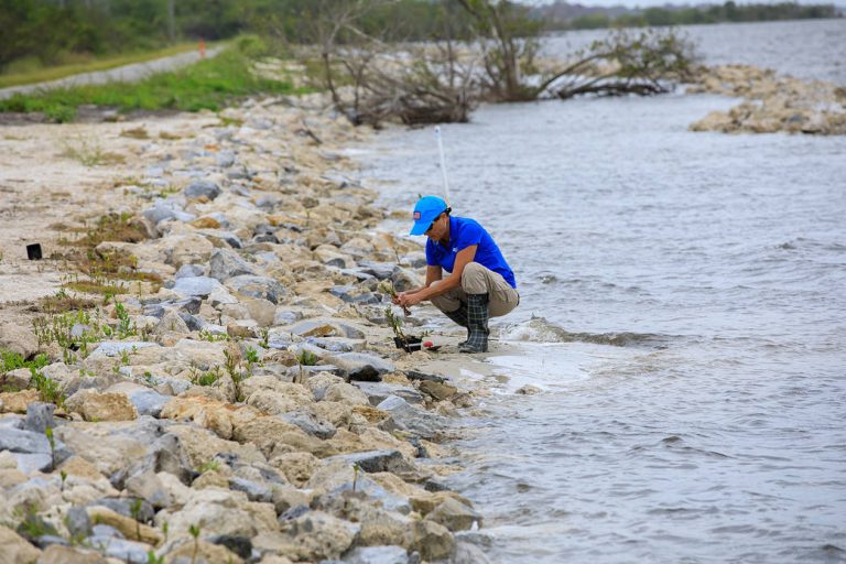
用红树林稳定海岸线

A team member from the Environmental Management Branch at NASA’s Kennedy Space Center works to remove a mangrove seedling deposited by tropical winds on the shoreline of KARS Park at Kennedy in this image from April 12, 2023. This spring, workers in the area replaced sand and finished an offshore wave break. The mangroves will be repotted and held in nearby ...

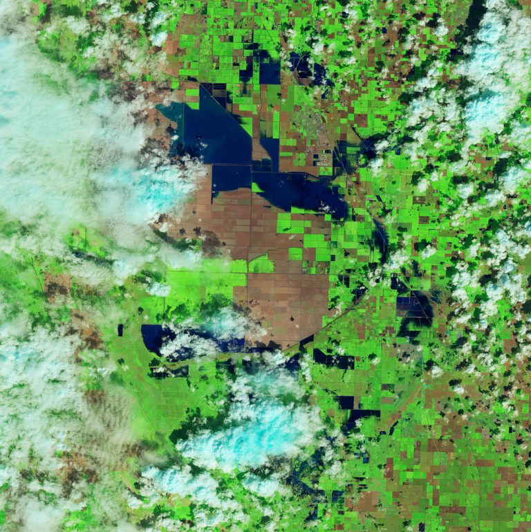
暴雨和大雪使图莱里湖恢复生机

Floodwater (dark blue) stands out against the vegetation in agricultural fields around Tulare Lake near Corcoran, California, in this enhanced color image taken by Landsat 8 on March 29, 2023. Heavy rain and snow in the first three months of 2023 have once again brought water to Tulare’s lakebed, but also flooding several nearby towns. 2023 has been the wett...

路易斯安那州的稻田

This Feb 3, 2023, enhanced-color image from Landsat 9 highlights a green and blue patchwork pattern in flooded rice fields in southwestern Louisiana. Raised levees used for water management form the grid pattern between the fields, which appear dark blue. As it flowed through several southern states over tens of thousands of years, the Mississippi River left...

颜色爆炸; 美丽的地球

This image, captured by the Landsat 8 satellite, shows the view over Western Australia on May 12, 2013. The image shows rich sediment and nutrient patterns in a tropical estuary area and complex patterns and conditions in vegetated areas. 这张由地球资源卫星8号拍摄的图像显示了2013年5月12日澳大利亚西部的景色。该图像显示了热带河口地区丰富的沉积物和养分模式以及植被区的复杂模式和条件。 The image is enhanced and involved masking, ...

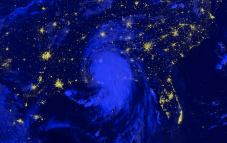
2021年度灾难:回顾

In 2021, Hurricane Ida left over 1 million people without power, tornadoes tore across the American Midwest, volcanoes forced people to evacuate their homes, wildfires covered the American West and unusual flooding wreaked havoc on Central Europe. 2021年,飓风艾达导致100多万人断电,龙卷风席卷美国中西部,火山爆发迫使人们撤离家园,野火覆盖美国西部,罕见的洪水对中欧造成严重破坏。 Some characteristics of natural hazards, s...

NASA启动新任务以监测地球景观

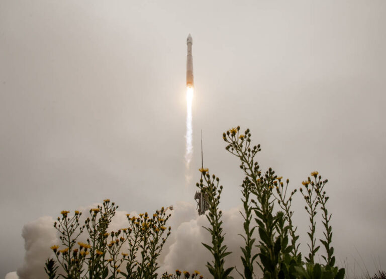
2021年9月27日星期一,联合发射联盟(ULA)的阿特拉斯五号火箭携带地球资源卫星9号从加利福尼亚州范登堡空军基地的3号航天发射场发射。地球资源卫星9号是美国国家航空航天局/美国地质调查局的一项联合任务,它将延续监测地球陆地和沿海地区的传统。 影像来源:美国国家航空航天局/比尔·英格尔斯 美国国家航空航天局(NASA)为监测地球陆地表面而建造的地球资源卫星9号,于美国东部时间星期一下午2点12分从加利福尼亚州范登堡空军基地成功发射。 作为与美国地质调查局(USGS)的一项联合任务,地球资源卫星9号由联合发射联盟的宇宙神Ⅴ号火箭从范登堡航天发射场3E升空。挪威的斯瓦尔巴群岛卫星监测地面站在发射后约83分钟获得了航天器的信号。地球资源卫星9号在到达其最终轨道高度438英里(705公里)时的性能与预期相符。 “NA...

Landsat 9号卫星就位进行封装

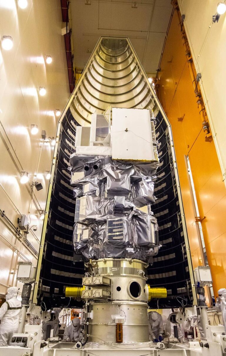
Inside the Integrated Processing Facility at Vandenberg Space Force Base in California, the Landsat 9 spacecraft is moved into position for encapsulation on Aug. 16, 2021. The two halves of the United Launch Alliance (ULA) payload fairing will surround and encase Landsat 9 to protect it during launch atop the ULA Atlas V rocket. Landsat 9 will launch on the ...

气温升高推动北极绿化

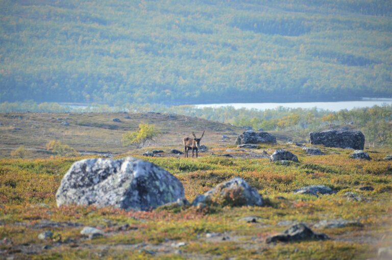
随着北极夏季变暖,地球北部的地貌也在发生变化。一项新的研究利用卫星图像追踪几十年来全球苔原生态系统,发现该地区变得更加绿色,因为温暖的空气和土壤温度导致植物生长增加。 “北极苔原是地球上最冷的生物群落之一,也是变暖速度最快的地区之一,”领导这项最新研究的美国弗拉格斯塔夫北亚利桑那大学的全球变化生态学家洛根·伯纳(Logan Berner)说。“我们看到的北极变绿确实是全球气候变化的风向标——这是对气温上升的生物群落规模的反应。” 来自NASA/USGS Landsat卫星的数据显示,在1985-2016年期间,加拿大、阿拉斯加和欧亚大陆西部北极苔原的植被绿化率增加了38%,这意味着植物生长得更多,变得更密集,以及/或灌木侵蚀了典型的苔原草和苔藓。 来源:NASA’s Goddard Space Fl...