喜马拉雅山脉上空的巨大喷流

喜马拉雅山脉上空的巨大喷流

A landscape showing a night sky over distant mountains is shown. Lakes dot the foreground in front of the mountains. Extending from above the mountains into the night sky are six bright jets. The jets are violet at the bottom but red at the top. Please see the explanation for more detailed information.
图中是一幅风景画,画中远处群山之上是夜空。群山前方,湖泊点缀在前景中。六条明亮的喷流从群山之上延伸到夜空中。喷流底部呈紫色,顶部呈红色。有关更多详细信息,请参阅说明。

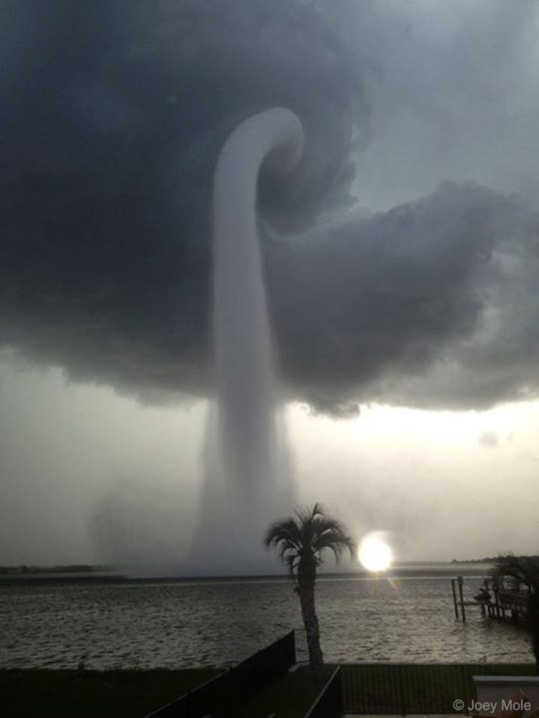
佛罗里达的水龙卷

佛罗里达的水龙卷

2023年4月23日 A Waterspout in Florida Image Credit & Copyright: Joey Mole Explanation: What’s happening over the water? Pictured here is one of the better images yet recorded of a waterspout, a type of tornado that occurs over water. Waterspouts are spinning columns of rising moist air that typically form over warm water. Waterspouts can be as dangerous as tornadoes and can feature wind speeds over 200 kilometers per hour. Some waterspouts form away from thunderstorms and even during relatively fair weather. Waterspouts may be relatively transparent and initially visible only by an unusual pattern they create on the water. The featured image was taken in 2013 July near Tampa Bay, Florida. The Atlantic Ocean off the coast of Florida is arguably the most active area…

落日时分远离的雷暴云

落日时分远离的雷暴云

2022年1月16日 A Retreating Thunderstorm at Sunset Image Credit & Copyright: Alan Dyer (The Amazing Sky) Explanation: What type of cloud is that? This retreating cumulonimbus cloud, more commonly called a thundercloud, is somewhat unusual as it contains the unusual bumpiness of a mammatus cloud on the near end, while simultaneously producing falling rain on the far end. Taken in mid-2013 in southern Alberta, Canada, the cloud is moving to the east, into the distance, as the sun sets in the west, behind the camera. In the featured image, graphic sunset colors cross the sky to give the already photogenic cloud striking orange and pink hues. A darkening blue sky covers the background. Further in the distance, a rising, waxing, gibbous moon is visible on the…

美国德州上空的超级胞雷暴系统

美国德州上空的超级胞雷暴系统

2021年06月13日 A Supercell Thunderstorm Over Texas Video Credit & Copyright: Mike Olbinski; Music: Impact Lento (Kevin MacLeod, Incompetech) Explanation: Is that a cloud or an alien spaceship? It’s an unusual and sometimes dangerous type of thunderstorm cloud called a supercell. Supercells may spawn damaging tornados, hail, downbursts of air, or drenching rain. Or they may just look impressive. A supercell harbors a mesocyclone — a rising column of air surrounded by drafts of falling air. Supercells could occur over many places on Earth but are particularly common in Tornado Alley of the USA. Featured here are four time-lapse sequences of a supercell in 2013 rotating above and moving across Booker, Texas. Captured in the video are new clouds forming near the storm center, dust swirling…