夜间飞越地球II

夜间飞越地球II

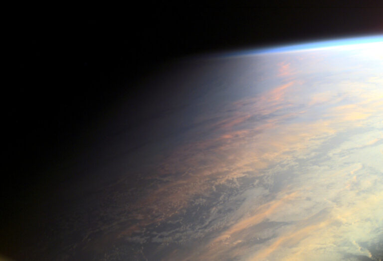
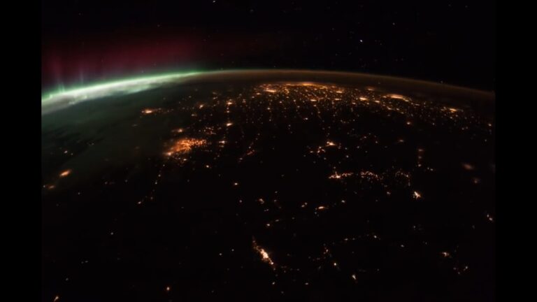
2021年04月23日 Flying Over the Earth at Night II Video Credit: NASA, Gateway to Astronaut Photography, ISS Expedition 53; Music: The Low Seas (The 126ers) Explanation: Recorded during 2017, timelapse sequences from the International Space Station are compiled in this serene video of planet Earth at Night. Fans of low Earth orbit can start by enjoying the view as green and red aurora borealis slather up the sky. The night scene tracks from northwest to southeast across North America, toward the Gulf of Mexico and the Florida coast. A second sequence follows European city lights, crosses the Mediterranean Sea, and passes over a bright Nile river in northern Africa. Seen from the orbital outpost, erratic flashes of lightning appear in thunder storms below and stars rise…

金窝银窝不如自己家里的狗窝

金窝银窝不如自己家里的狗窝

The Namibian desert landscape stretches as far as the eye can see in this 2016 image of sunset at Gobabeb, Namibia. The sky changes colors as the Sun sinks behind the dunes in the west. This is but one of the many varied and changing landscapes on the planet we call home. See more NASA Earth Day 2021 features. #EarthDay #ConnectedByEarth Image Credit: NASA/Jane Peterson 在这张2016年拍摄的纳米比亚戈巴布日落照片中,纳米比亚的沙漠景观延伸到视线所及之处。当太阳落在西边沙丘的后面时,天空的颜色也随之改变。 这只是我们称之为家园的这个星球上许多不同的和不断变化的景观之一。查看更多NASA2021年地球日专题。 #EarthDay #ConnectedByEarth 图片来源:美国宇航局/简·彼得森

暮光时分的地球

暮光时分的地球

2021年04月22日 Planet Earth at Twilight Image Credit: ISS Expedition 2 Crew, Gateway to Astronaut Photography of Earth, NASA Explanation: No sudden, sharp boundary marks the passage of day into night in this gorgeous view of ocean and clouds over our fair planet Earth. Instead, the shadow line or terminator is diffuse and shows the gradual transition to darkness we experience as twilight. With the Sun illuminating the scene from the right, the cloud tops reflect gently reddened sunlight filtered through the dusty troposphere, the lowest layer of the planet’s nurturing atmosphere. A clear high altitude layer, visible along the dayside’s upper edge, scatters blue sunlight and fades into the blackness of space. This picture was taken in June of 2001 from the International Space Station…

我们称之为家的地方

我们称之为家的地方

In this image that astronaut Scott Kelly posted to Twitter on Aug. 9, 2015 during his #YearInSpace captures all the the places humans dwell – the Earth, the International Space Station and the Milky Way. His accompanying caption read: “Day 135. #MilkyWay. You’re old, dusty, gassy and warped. But beautiful. Good night from @space_station! #YearInSpace”. #EarthDay Image Credit: NASA/Scott Kelly 2015年8月9日,宇航员斯科特·凯利在推特上发布了这张照片,这是他在太空#YearInSpace中拍摄的所有人类居住的地方——地球、国际空间站和银河系。 他的配文是:“第135天。#MilkyWay。你又老又脏,又臭又翘,但美丽。来自@space_station的晚安! #YearInSpace”。 #EarthDay 图片来源:NASA/Scott Kelly

夜色中的东京

夜色中的东京

The night lights of Tokyo, Japan, are pictured from the International Space Station as it orbited 261 miles above the island nation in this image from February 2021. Image Credit: NASA 2021年2月,国际空间站在这个岛国上空围绕261英里的轨道运行时,拍摄到了日本东京的夜光。 图片来源:美国国家航空航天局

研究环境和COVID-19

研究环境和COVID-19

Today is World Health Day and NASA’s Earth Science Division is using information from our Earth-observing satellites, surface sensors, and computer-based datasets to study the environmental, economic, and societal impacts of the COVID-19 pandemic and to determine whether environmental factors influence the spread of the virus. While scientists around the world often have been confined to their homes during the COVID-19 pandemic, Earth observing satellites continue to orbit and send back images that reveal connections between the pandemic and the environment. NASA began funding eight new projects last fall to look at COVID-19 and the environment. This image shows the ECOSTRESS land surface temperature variations measured on May 22, 2020, during the full lockdown period over an area centered on the Great Mall in Milpitas,…

探索地球的水

探索地球的水

NASA has investigated humanity’s impact on a number of our home planet’s natural resources and recently explored our impact on freshwater resources. Scientists have now completed the first global accounting of fluctuating water levels in Earth’s lakes and reservoirs – including ones previously too small to measure from space. The research, published March 3 in the journal Nature, relied on NASA’s Ice, Cloud and land Elevation Satellite 2 (ICESat-2), launched in September 2018. ICESat-2 sends 10,000 laser light pulses every second down to Earth. When reflected back to the satellite, those pulses deliver high-precision surface height measurements every 28 inches (70 centimeters) along the satellite’s orbit. With these trillions of data points, scientists can distinguish more features of Earth’s surface, like small lakes and ponds,…

美国宇航局和梅里特岛野生动物保护区

美国宇航局和梅里特岛野生动物保护区

Did you know that NASA’s Kennedy Space Center shares its home with the Merritt Island National Wildlife Refuge? In this image from 2014, a great egret strikes a classic pose amid the brush on Kennedy Space Center in Florida. The undeveloped property on Kennedy is managed by the U.S. Fish and Wildlife Service through the Merritt Island National Wildlife Refuge. The refuge provides a habitat for a plethora of wildlife, including 330 species of birds. For information on the refuge, visit http://www.fws.gov/merrittisland/Index.html. #WorldWildlifeDay Image Credit: NASA/Daniel Casper 你知道美国宇航局的肯尼迪航天中心和梅里特岛国家野生动物保护区共用一个家吗? 在这张2014年的照片中,大白鹭在佛罗里达州肯尼迪航天中心的灌木丛中摆出经典姿势。肯尼迪岛的这块未开发地产由美国鱼类和野生动物管理局通过梅里特岛国家野生动物保护区管理。该保护区为包括330种鸟类在内的大量野生动物提供了栖息地。有关保护区的信息,请访问http://www.fws.gov/merrittisland/Index.html。 #WorldWildlifeDay 图片来源:美国宇航局/丹尼尔·卡斯帕

极光与树

极光与树

2021年02月28日 The Aurora Tree Image Credit & Copyright: Alyn Wallace Explanation: Yes, but can your tree do this? Pictured is a visual coincidence between the dark branches of a nearby tree and bright glow of a distant aurora. The beauty of the aurora — combined with how it seemed to mimic a tree right nearby — mesmerized the photographer to such a degree that he momentarily forgot to take pictures. When viewed at the right angle, it seemed that this tree had aurora for leaves. Fortunately, before the aurora morphed into a different overall shape, he came to his senses and capture the awe-inspiring momentary coincidence. Typically triggered by solar explosions, aurora are caused by high energy electrons impacting the Earth’s atmosphere around 150 kilometers…

太平洋上空的日出

太平洋上空的日出

This view of a sunrise breaking through the Earth’s horizon was taken on Feb 3, 2021, as the International Space Station orbited 271 miles above the Pacific Ocean off the coast of southern Chile in South America. The space station, humanity’s only orbital laboratory, orbits the Earth about every 90 minutes, witnessing around 16 sunrises each day. Image Credit: NASA 这张冲破地球地平线的日出照片拍摄于2021年2月3日,当时国际空间站在距南美洲智利南部海岸271英里的太平洋上空环绕飞行。国际空间站是人类唯一的轨道实验室,它每90分钟绕地球公转一圈,每天见证大约16次日出。 图片来源:美国国家航空航天局