标签: ice

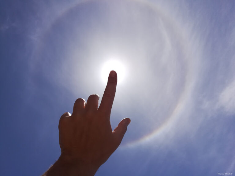
日晕环

2023年10月14日 Circular Sun Halo Image Credit & Copyright: Vincenzo Mirabella Explanation: Want to see a ring around the Sun? It’s easy to do in daytime skies around the world. Created by randomly oriented ice crystals in thin high cirrus clouds, circular 22 degree halos are visible much more often than rainbows. This one was captured by smart phone ...

哈德逊湾冰层加速破裂

The Visible Infrared Imaging Radiometer Suite on the National Oceanic and Atmospheric Administration’s NOAA-20 satellite captured this image of fragmented ice in Hudson Bay on June 28, 2023. The sea ice typically melts away between June and August, and the bay begins to freeze over again in late October or November. The ebb and flow of ice and its distributi...

冰雪星辰

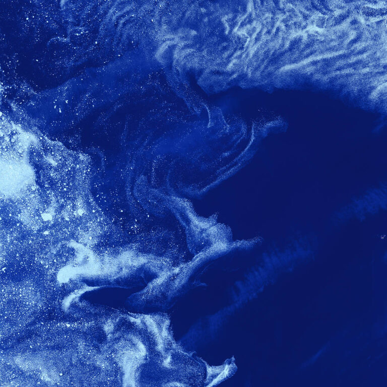
Like distant galaxies amid clouds of interstellar dust, chunks of sea ice drift through graceful swirls of grease ice in the frigid waters of Foxe Basin near Baffin Island in the Canadian Arctic. Sea ice often begins as grease ice, a soupy slick of tiny ice crystals on the ocean’s surface. As the temperature drops, grease ice thickens and coalesces int...

OMG:冰之美

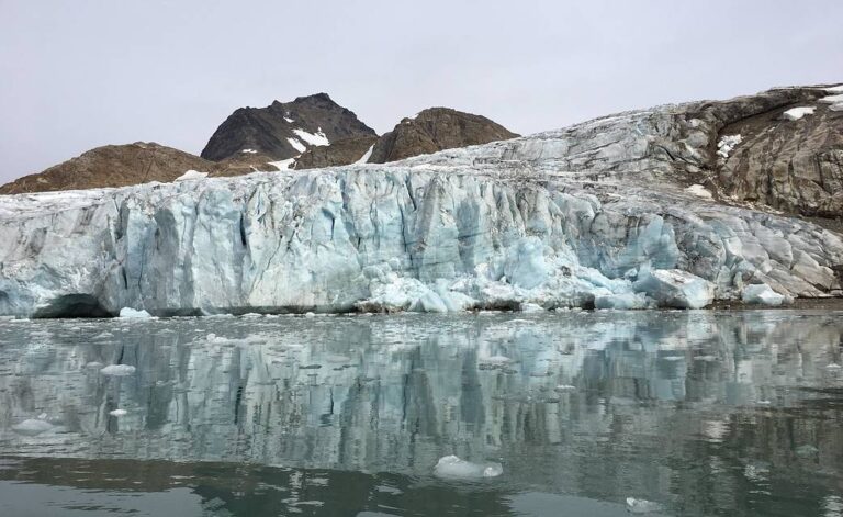
NASA’s Oceans Melting Greenland, or OMG, airborne mission found that most of Greenland’s glaciers that empty into the ocean are at greater risk of rapid ice loss than previously understood. OMG’s six-year field campaign studied the ocean’s role in glacial ice loss by gathering precise measurements of ocean depth, temperature, and sali...

冰冷的“胶水”可能控制着南极冰架断裂的速度

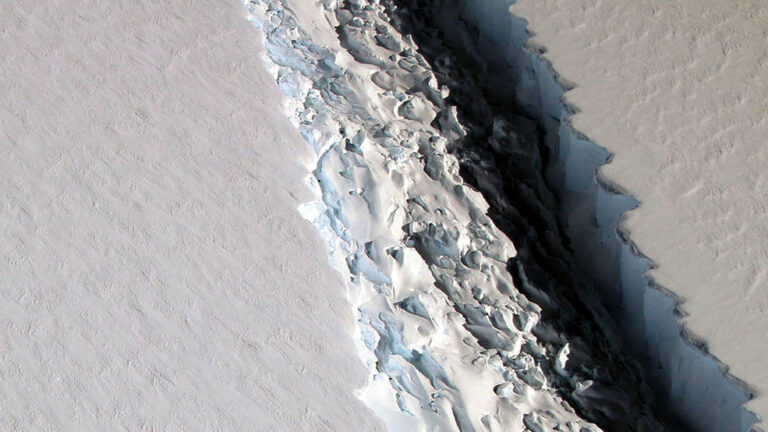
这张2016年的照片显示了一条裂缝,在几个月内,裂缝进一步扩大,并从南极洲的拉森C冰架上释放出一座特拉华州大小的冰山。在裂缝的一侧可以看到mélange的粗糙表面。 影像来源:NASA/GSFC/OIB 随着南极洲冰架上被称为“mélange”的冰雪碎石融化,即使在寒冷的冬天,裂缝也会扩大,冰山也会断裂。 位于南加州的美国宇航局喷气推进实验室和加州大学欧文分校的研究人员发现了一个冰雪过程,可能导致一座特拉华州大小的冰山在2017年南半球的巨大拉森C冰架上断裂。这一发现表明,mélange——一种风吹雪、冰山碎片以及冰架内和周围的海冰的混合物——于将冰架固定在一起至关重要。这一发现意味着,由于气温上升,这些冰架的破裂速度可能比科学家预期的还要快。 冰架是延伸到海洋上的冰川漂浮的舌头,减缓了南极洲的冰川对全球海平面...

NASA卫星显示云层如何应对北极海冰的变化

在预测北极地区未来将继续变暖的程度和速度方面,云层是最大的不确定因素之一。根据一年中的不同时间以及它们形成和存在的不断变化的环境,云既可以起到保温的作用,也可以冷却它们下面的海面。 几十年来,科学家们一直认为,北极海冰覆盖面积的减少使得更多的云在海洋表面附近形成。现在,NASA的一项新研究表明,暴露的海洋通过海冰上一个被称为“冰间湖(polynya)”的大洞释放热量和水分,促进了更多云的形成,这些云捕获了大气中的热量,阻碍了新海冰的再冻结。 这一发现来自于一项对位于格陵兰岛和加拿大之间的巴芬湾北部被称为北方水域冰间湖的研究。该研究是最早利用卫星上的主动传感器探测冰间湖与云之间相互作用的研究之一,科学家们可以利用卫星上的主动传感器分析大气中低层和高层的垂直云层。 领导这项研究的美国宇航局汉普顿兰利研究中心的大气科...

巴芬湾,格陵兰岛:一个历史的视角

Acquired by the Landsat 7 satellite more than 20 years ago on Sept. 3, 2000, this image is of Greenland’s western coast and the small field of glaciers that surrounds Baffin Bay. This is a false-color composite image made using near-infrared, red, and blue wavelengths. 20多年前的2000年9月3日,陆地卫星7号拍摄了这张照片,这是格陵兰岛的西海岸和环绕巴芬湾的小块冰川区域。这是一张使用近红外、红色和蓝色波长制作的假彩色合成图像。 N...

太空激光以惊人的精度绘制南极洲的融水湖图

从天空上看,南极洲冰盖可能看起来像一个平静的、永久的冰毯,已经覆盖南极洲数百万年了。但是,冰盖最厚时可达数千米深,在其底部与大陆基岩相接处隐藏着数百个融水湖。在地表深处,一些湖泊通过水道系统不断充盈和排水,最终排入海洋。 现在,有了NASA在太空中使用过的最先进的地球观测激光仪器,科学家们改进了他们对南极西部冰盖下隐藏湖泊系统的地图,并发现了另外两个活跃的冰川下湖泊。 这项新的研究为从太空中发现新的冰川下湖泊,以及评估这一隐藏的管道系统如何影响冰块滑入南大洋的速度,增加可能改变其循环和生态系统的淡水,提供了关键的见解。 NASA的冰、云和陆地海拔卫星2号(ICESat-2),让科学家们能够精确地绘制冰川下湖泊的地图。卫星测量了冰层的高度。尽管冰层非常厚,但冰层会随着冰层下湖泊的充盈或清空而上升或下降。 数以百计...

日晕

2021年06月10日 Circular Sun Halo Image Credit & Copyright: Vincenzo Mirabella Explanation: Want to see a ring around the Sun? It’s easy to do in daytime skies around the world. Created by randomly oriented ice crystals in thin high cirrus clouds, circular 22 degree halos are visible much more often than rainbows. This one was captured by smart phone ...