标签: Suomi NPP

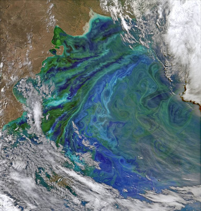
巴塔哥尼亚浮游生物漩涡

Phytoplankton create rich blooms of color in the Atlantic Ocean near South America in this enhanced color image from Dec. 2, 2014. The Patagonian Shelf Break is a biologically rich patch of ocean where airborne dust from the land, iron-rich currents from the south, and upwelling currents from the depths provide a bounty of nutrients for phytoplankton. The ba...

2021年度灾难:回顾

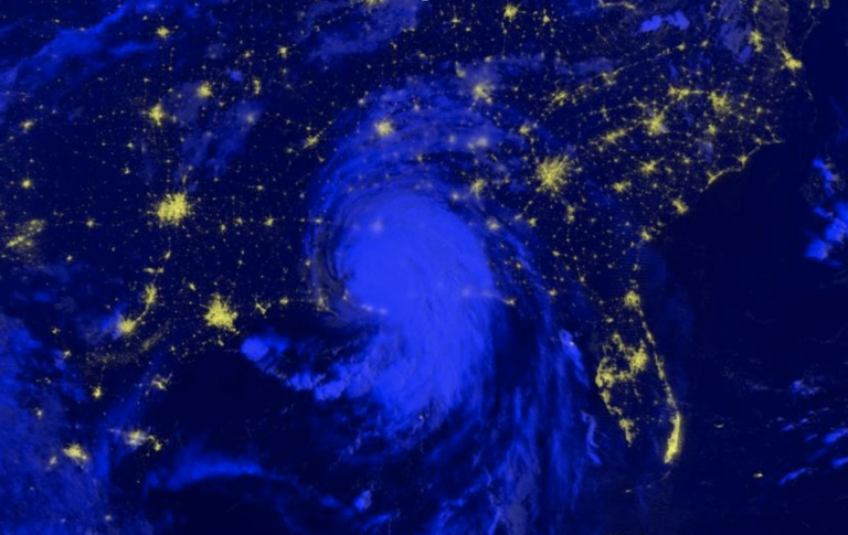
In 2021, Hurricane Ida left over 1 million people without power, tornadoes tore across the American Midwest, volcanoes forced people to evacuate their homes, wildfires covered the American West and unusual flooding wreaked havoc on Central Europe. 2021年,飓风艾达导致100多万人断电,龙卷风席卷美国中西部,火山爆发迫使人们撤离家园,野火覆盖美国西部,罕见的洪水对中欧造成严重破坏。 Some characteristics of natural hazards, s...

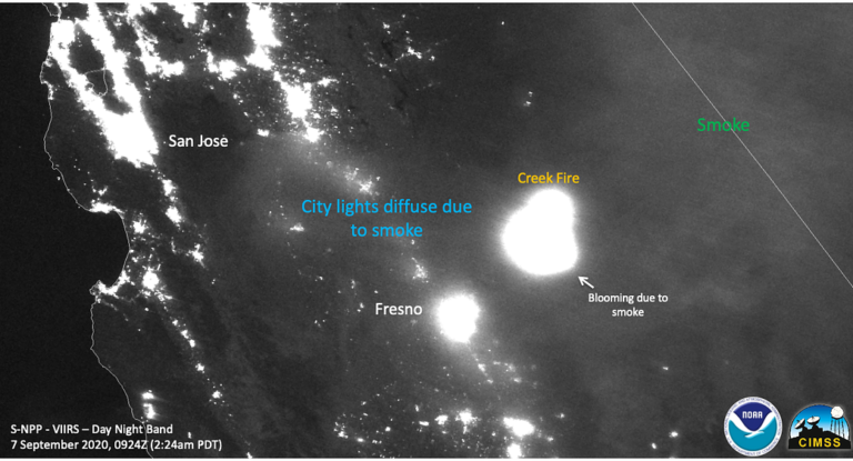
加州夜晚的克里克大火

This NOAA/NASA Suomi NPP satellite image from Sept. 7, 2020, shows the night band image of the Creek Fire at night as well as the smoke from the fire causing lights at night to diffuse or “bloom.” NASA’s satellite instruments are often the first to detect wildfires burning in remote regions, and the locations of new fires are sent directly to lan...

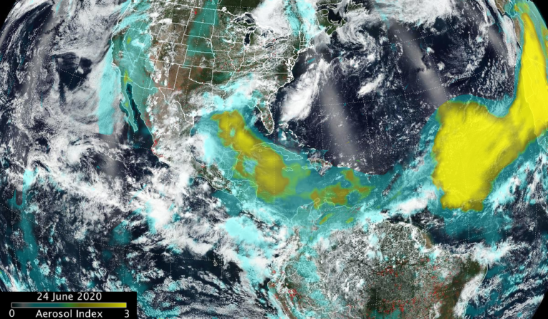
NASA-NOAA的Suomi NPP卫星分析了撒哈拉沙尘暴气溶胶层

沙尘暴从非洲的撒哈拉沙漠穿越大西洋并不是什么新鲜事,但目前的沙尘暴范围相当大,美国宇航局的卫星也观测到了6月份巨大的沙尘暴。美国国家航空航天局和国家海洋和大气管理局的Suomi NPP卫星显示,沙尘暴已经移动到墨西哥湾,延伸到中美洲和东太平洋的部分地区。 这张2020年6月24日的图片来自Suomi NPP OMPS气溶胶指数。沙尘暴掠过尤卡坦半岛,并穿过墨西哥湾。在大西洋的东部和中部可以看到沙尘暴最大和最厚的部分。 来源:NASA/NOAA, Colin Seftor NASA使用卫星和其他资源来追踪由沙尘、烟雾和火山灰组成的气溶胶颗粒。Suomi NPP上的可见红外成像辐射计套件(VIIRS)仪器提供可见图像,而Suomi-NPP卫星上的臭臭氧测绘和分析套件(OMPS)天底绘制器(NM)提供了吸收气溶胶指数...

黑色大理石:我们的星球在璀璨的黑暗中

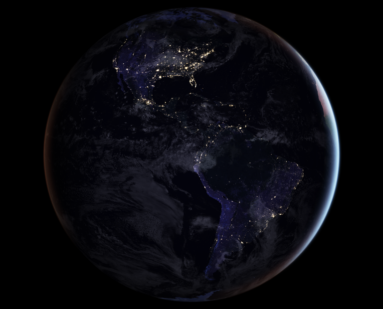
In the years since the 2011 launch of the NASA-NOAA Suomi National Polar-orbiting Partnership (NPP) satellite, a research team at the agency’s Goddard Space Flight Center has been analyzing night-lights data and developing new software and algorithms to make night lights imagery clearer, more accurate and readily available. This is one of several global imag...

NASA制作了澳大利亚火灾产生的烟雾和气溶胶的世界路径动画

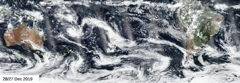
由NASA组成的卫星团队一直在分析澳大利亚大火产生的气溶胶和烟雾。 VIIIRS红绿蓝图像提供了烟雾的“真彩”视图。(请注意,这些图像并不代表人类从轨道上看到的图像。在这些图像中,已经去除了会增加“蓝色雾”的瑞利散射效应。)尽管有用,但通常很难分辨云层上的烟雾,有时也很难分辨黑暗的海面上的烟雾。 来源:NASA/ColinSeftor 澳大利亚的大火不仅在当地造成破坏。前所未有的条件,包括灼热和历史干燥,导致形成了异常大量的火积云(pyrCbs)事件。火积云基本上是火灾引起的雷暴。它们是由过热的上升气流引起的灰烬,烟雾和燃烧材料的上升引起的。随着这些物质的冷却,形成了类似于传统雷暴的云,但没有伴随的降水。 火积云事件为烟雾到达高空超过10英里(16公里)的平流层提供了途径。一旦进入平流层,烟雾可从其源头传播数千...

降雨暂时缓解了澳大利亚的火灾

NASA的卫星数据继续提供有关澳大利亚大规模火灾产生的烟雾和气溶胶的信息。澳大利亚新南威尔士州和维多利亚州部分地区遭遇强降雨,官员们已经警告居民,大火(以及由此产生的烟雾和气溶胶)将在周四炎热、干燥的天气和大风到来之前卷土重来。澳大利亚面临的下一个不幸是,大火可能很快就会合并起来,在已经受灾的地区引发大火。降雨无非是让居民在大火恢复原状之前有时间重新集结。即使有雨后的喘息,该地区的雾霾和烟雾仍处于危险范围内。NASA的NOAA卫星在2020年1月4日拍摄到了这张令人震惊的受火灾和烟雾影响地区的卫星图像。直到1月5日至6月6日,降雨才开始影响火势。在这张卫星图像中,从火中冒出的烟雾可以清楚地表现为从北向南分成三股褐色-灰色的滚滚烟云。 这张2020年1月4日的Suomi-NPP卫星图像显示了澳大利亚大火产生的烟雾...

璀璨的夜空:黑暗中的美洲

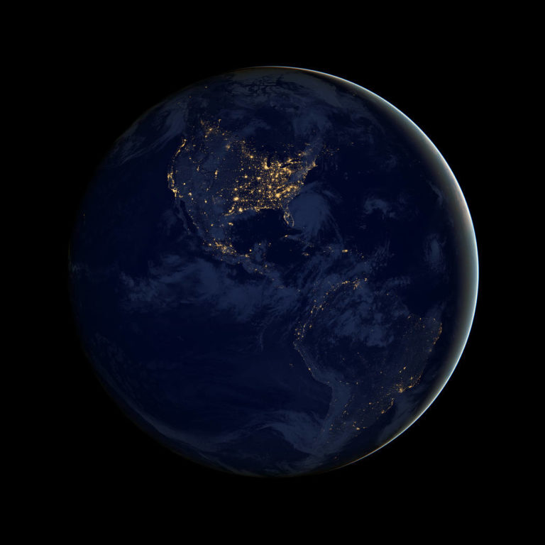
This image of North and South America at night is a composite assembled from data acquired by the Suomi NPP satellite in April and October 2012. The new data was mapped over existing Blue Marble imagery of Earth to provide a realistic view of the planet. For more such images of our planet, read Earth at Night, NASA’s latest ebook that features dazzling...

巴西热带雨林的野火产生了跨越国家的烟雾

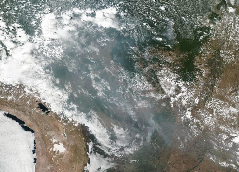
This natural-color image of smoke and fires in several states within Brazil including Amazonas, Mato Grosso, and Rondônia was collected by NOAA/NASA’s Suomi NPP using the VIIRS (Visible Infrared Imaging Radiometer Suite) instrument on August 20, 2019. It is not unusual to see fires in Brazil at this time of year due to high temperatures and low humidit...