We’re celebrating 50 years of the Landsat satellite, the first of which launched on July 23, 1972. The latest in the series, Landsat 9, launched in September 2021.
Landsat shows us Earth from space. For 50 years, the mission has collected data on the forests, farms, urban areas and freshwater of our home planet, generating the longest continuous record of its kind. Decision makers from across the globe use freely available Landsat data to better understand environmental change, manage agricultural practices, allocate scarce water resources, respond to natural disasters and more.
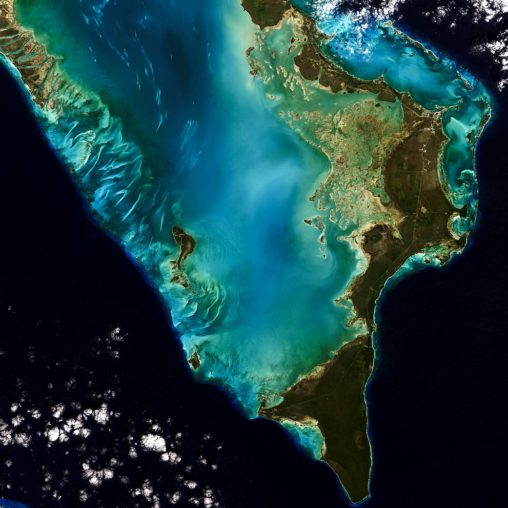
This natural color image of Eleuthera Island, the Bahamas, was taken by Landsat 9 on January 18, 2022. Between Landsat 8 and Landsat 9, the Landsat program delivers complete coverage of the Earth’s surface every eight days.
Image Credit: Michelle Bouchard using Landsat data from USGS
我们正在庆祝地球资源卫星50周年,其中第一颗卫星于1972年7月23日发射。该系列中最新的地球资源卫星9号于2021年9月发射。
地球资源卫星从太空向我们展示了地球。50年来,该任务收集了关于我们地球家园的森林、农场、城市地区和淡水的数据,创造了此类数据中持续时间最长的记录。来自全球的决策者使用免费提供的地球资源卫星数据来更好地了解环境变化、管理农业实践、分配稀缺的水资源、应对自然灾害等等。
这张巴哈马伊柳塞拉岛的自然彩色图像由地球资源卫星9号于2022年1月18日拍摄。在地球资源卫星8号和地球资源卫星9号之间,陆地卫星计划每八天对地球表面进行一次全面覆盖。
图片来源:Michelle Bouchard使用美国地质调查局的陆地卫星数据


